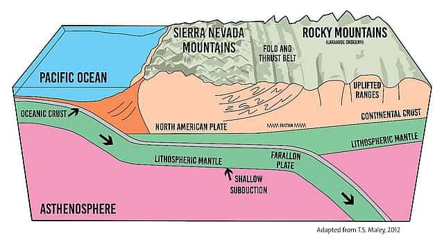
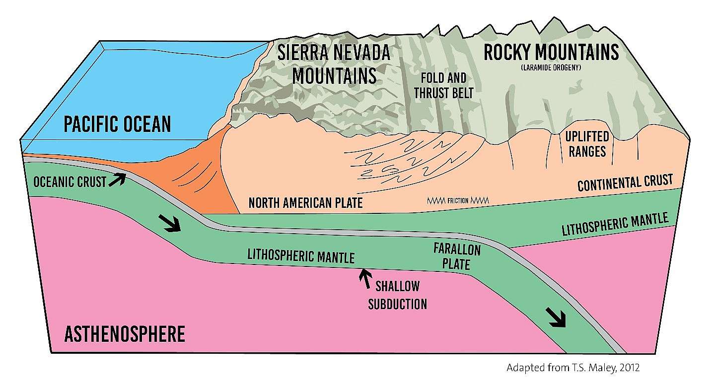
How the Rocky Mountains Formed: A Journey Through Changing Scientific Ideas

December 11, 2025
Written By
George Miller
George Miller is the Education Web Content Creator/Outreach Educator at the Buffalo Bill center of the West. George also facilitates Skype in the Classroom, teaching students nationally and internationally. George is a member of the American Association of Museums and holds a B.S. in Anthropology from the University of Utah and a M.Ed. in Adult Education from Oregon State University. Outside work, George teaches skiing at Red Lodge Mountain, enjoys whitewater rafting, painting, playing music and practicing yoga.
You May Also Like
Armed in the Colonies: Firearms, Militia, and Early American Law
Mar 16, 2026
American society has always been connected to firearms culture in...
Buffalo Bill Center of the West reaches out to classrooms world-wide
Jan 28, 2014
The Buffalo Bill Center of the West reaches out to...
Research Made Easy: Exploring the McCracken Research Library’s Collections
Mar 23, 2026
Archival and library research can feel overwhelming for even the...
Brida Gafford: The Wild Life of a Rodeo Superstar
Mar 04, 2026
“So they let you dress up like a cowgirl and...
The Bison Effect: How Bison Help Their Neighbors
Nov 17, 2025
Artist, Steve Leonardi, puts the finishing touches on his piece....
Sheep Wagons and the Shaping of the American West
Feb 17, 2026
A lone shepherd on Wyoming’s high plains awakens to the...
Inside the Reading Room: What to Know Before You Visit
Feb 12, 2026
The McCracken Research Library has a reading room that is...
Behind the Boxes: What an Archivist Really Does
Jan 05, 2026
When I tell people I’m an archivist, there are usually...
Why These Objects? A Closer Look at the Buffalo Nation Spotlights
Jan 29, 2026
As the opening of the Buffalo Nation spotlights approaches, a...
John Colter: America’s Intrepid Mountain Man
Jan 23, 2026
The Dawn of Westward Expansion Most historians agree that westward...
The Birth of the American Long Rifle
Feb 18, 2026
If any firearm were to define the colonial and foundational...